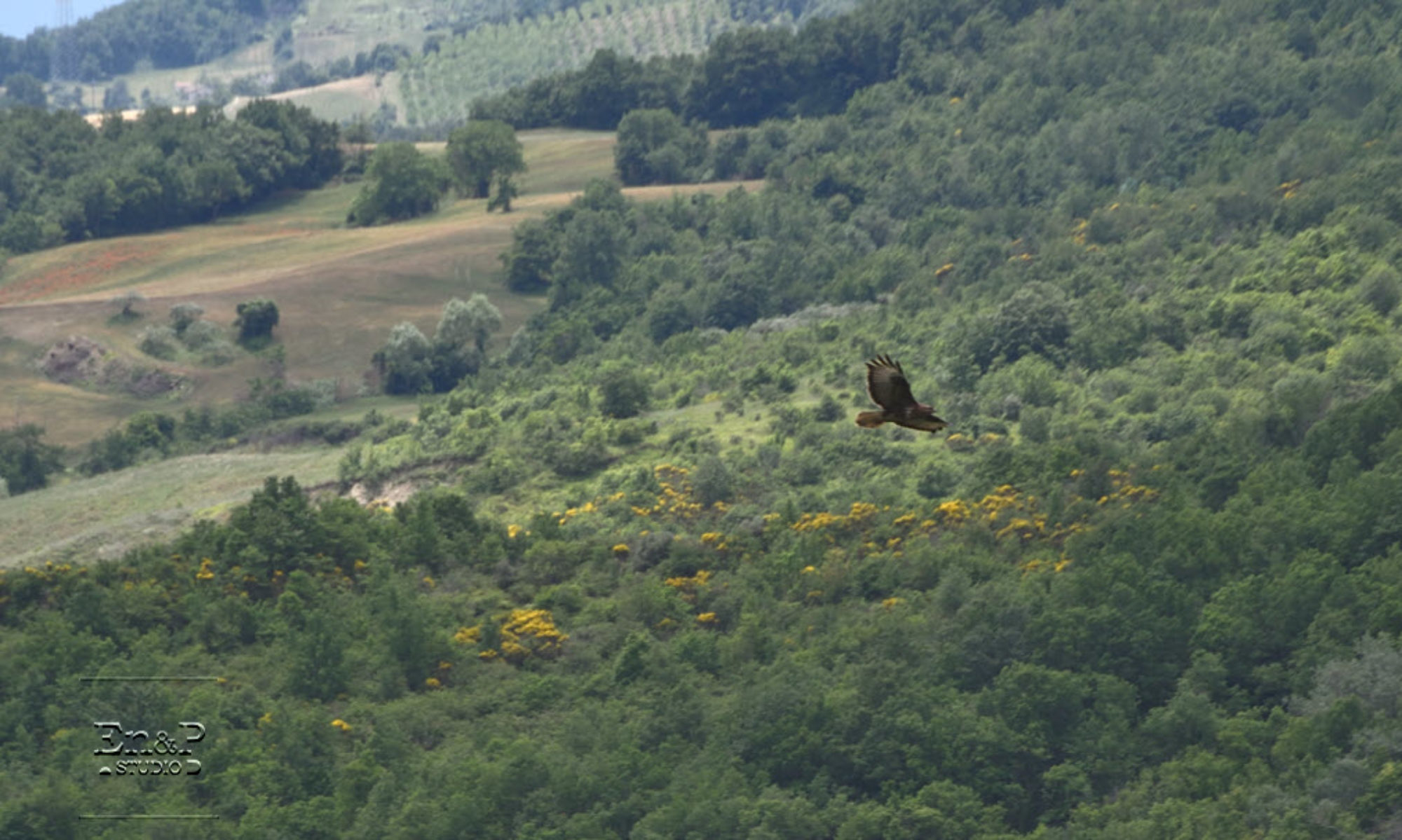
ARW – Advanced Research WRF – 3 km
ECM – European Centre for Medium-Range Weather Forecasts – 14 Km
® 2019 Consorzio LaMMA
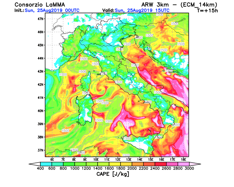
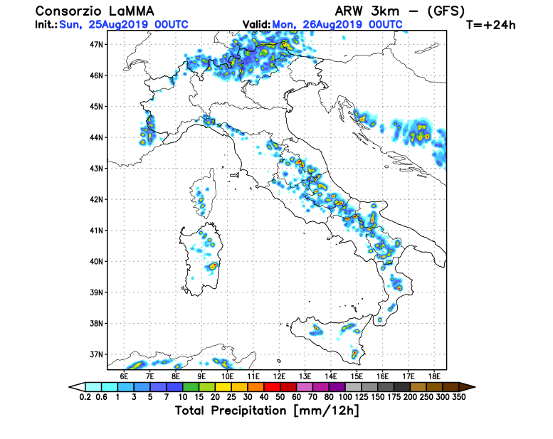
ARW – Advanced Research WRF – 3 km
GFS – Global Forecasting System
® 2019 Consorzio LaMMA
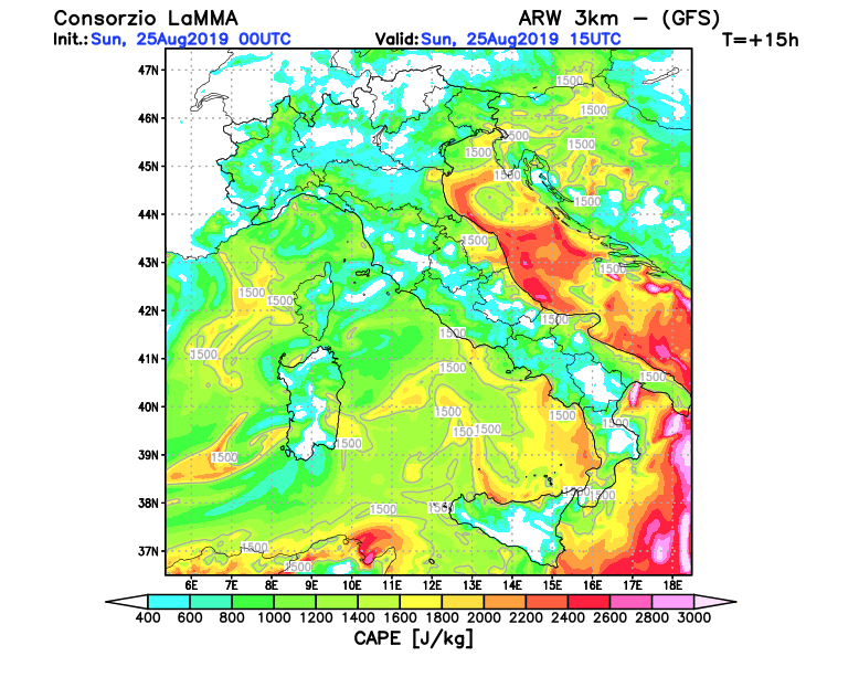
ARW – Advanced Research WRF – 3 km
ECM – European Centre for Medium-Range Weather Forecasts – 14 Km
® 2019 Consorzio LaMMA
ARW – Advanced Research WRF – 3 km
GFS – Global Forecasting System
® 2019 Consorzio LaMMA
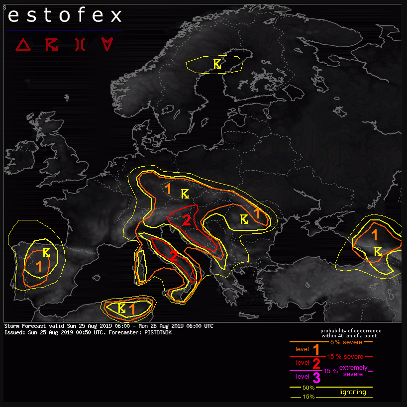
Valid: Sun 25 Aug 2019 06:00 to Mon 26 Aug 2019 06:00 UTC
Issued: Sun 25 Aug 2019 00:50
© ESTOFEX – European Storm Forecast Experiment
Level 1 and level 2 areas are issued for parts of NE Algeria, NW Tunisia, Corsica, Italy, Austria, Germany, the Czech Republic, Slovakia, Romania, Hungary, Slovenia, Croatia, Bosnia-Herzegovina, Montenegro, Albania, Georgia and SW Russia mainly for excessive convective precipitation and large hail. In addition, non-mesocyclonic tornadoes (waterspouts) are possible in coastal areas.
A level 1 is issued for parts of Portugal and W Spain for large hail, severe convective wind gusts and excessive convective precipitation.
A broad, subtropic ridge filled with very warm to hot air covers most of Europe. It is flanked by small cut-off lows near Ireland and Portugal and by a long-wave trough over Russia. The main frontal zone is deflected to the far north and runs across the Norwegian Sea and Scandinavia.
© ESTOFEX – European Storm Forecast Experiment